Fietskaarten - Europa
 Fietskaart - Wandelkaart 75027 Vosges du Nord - Mont Sainte Odile - Le Donon | IGN - Institut Géographique National
Bijzonder mooie wandel- en fietskaart van het noordelijk deel van de Vogezen op schaal 1:75.000, met vijf uitsneden met schaal 1:25.000 met de GR paden daarop aangegeven. De cartografie 75.000 …
★★★★★ Fietskaart - Wandelkaart 75028 Vosges du Sud - Ballon d'Alsace - Le Hohneck | IGN - Institut Géographique National
Bijzonder mooie wandel- en fietskaart van het zuidelijk deel van de Vogezen op schaal 1:75.000, met vijf uitsneden met schaal 1:25.000 met de GR paden daarop aangegeven. De cartografie …
★★★★★★★★★★ Fietskaart - Wandelkaart 75023 Pays Basque | IGN - Institut Géographique National
Bijzonder mooie wandel- en fietskaart van het westelijke deel van de Pyreneeen op schaal 1:75.000, met vijf uitsneden met schaal 1:25.000 met de GR paden daarop aangegeven. De cartografie 75.000 …
 Fietskaart - Wandelkaart 75030 Bastia Corte Corsica | IGN - Institut Géographique National
Bijzonder mooie wandel- en fietskaart van een deel van Corsica op schaal 1:75.000, met vijf uitsneden met schaal 1:25.000 met de GR paden daarop aangegeven. De cartografie 75.000 is …
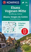
 Wandelkaart - Fietskaart 2221 Elsass - Vogesen Mitte, Alsace - Vosges du Centre | Kompass
Goede wandelkaart met vrijwel alle topografische details als hoogtelijnen, vegetatie, schaduwtekening maar ook de ingetekende wandelroutes en in veel gevallen ook fietsroutes (MTB). Gevaarlijke routes worden als zodanig weergegeven met …
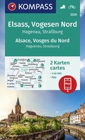
★★★★★ Wandelkaart - Fietskaart 2220 Elsass - Vogesen Nord, Alsace - Vosges du Nord | Kompass
Goede 2-delige wandelkaartenset met vrijwel alle topografische details als hoogtelijnen, vegetatie, schaduwtekening maar ook de ingetekende wandelroutes en in veel gevallen ook fietsroutes (MTB). Gevaarlijke routes worden als zodanig weergegeven …
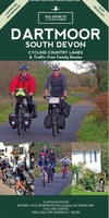
 Fietskaart Cycling guides Dartmoor - South Devon | Goldeneye
Dartmoor. One of England’s greater National Parks; the Forest of Dartmoor covers 365 square miles and contains the highest ground in England south of the Peak District. On its desolate …
 Fietskaart 14 Cycling guides Suffolk | Goldeneye
To be confronted with the variety and complexity of the cycling routes, trails and paths in Suffolk can be a bewildering experience. For it appears that the Suffolk County Council …
 Fietskaart ADFC Regionalkarte Traumhafte E-Bike-Touren im Erzgebirge | BVA BikeMedia
-Bike-Touren im Erzgebirge und rund um Chemnitz und Zwickau spezielle E-Bike-Karte mit E-Bike-Ladestationen und speziellen E-Bike-Tourenvorschlägen ideal für Tagesausflüge und Wochenendtouren Radeln in der Region Erzgebirge und …
 Fietskaart 767 Vélo en France - Frankrijk | Michelin
Een speciale kaart van Michelin die specifiek gericht is op het fietsen. De kaart geeft route-suggesties verspreid over heel Frankrijk. Op de achterzijde van de kaart worden deze routes meer …
 Fietskaart Kustroute Belgische Kust | NGI - Nationaal Geografisch Instituut
Handige overzichtskaart van de Kustroute, een lange fietsroute van 85 km langs de Belgische Kust. Deze route is bewegwijzerd.
 Wandelkaart - Fietskaart WKD5222 Müritz | Freytag & Berndt
Gedetailleerde wandelkaart met ingetekende wandelroutes Die Mecklenburgische Seenplatte bietet auch westlich von Müritz eine reizvolle Landschaft mit Kölpin-, Fleesen- und Plauer See sowie ausgedehnten Kiefernwäldern und weiter Moor- und Heidelandschaft. …
 Wandelkaart - Fietskaart WKD5203 Chiemsee | Freytag & Berndt
Gedetailleerde wandelkaart met ingetekende wandelroutes en een kleine info-gids. Der Chiemsee bildet den Mittelpunkt der Karte. Ufernahe Rad- und Wanderwege lassen ihn erkunden, führen zu Schiffsanlegern, um Herren- und Fraueninsel …
 Fietskaart Stirling / Forth Valley &The Trossachs | Harvey Maps
Cycling map of Stirling, the Forth Valley and the Trossachs at 1:80,000 scale Map shows 16 graded cycle routes with detailed route descriptions on reverse Includes enlargement of …
 Fietskaart Dales Noord | Harvey Maps
Detailed map with off-road cycle routes. GPS compatible. Rights of Way. Large area on a compact sheet. Yorkshire Dales North covers Swaledale and Wensleydale, including Keld, Hawes, Aysgarth and Leyburn.
 Fietskaart Dartmoor | Harvey Maps
New map for cycling on Dartmoor and the surrounding area. 2 maps in one: one side mountain biking the other side for cycle touring Tried and tested cycle …
 Fietskaart Cycle Rides in the Yorkshire Dales | Harvey Maps
8 cycle rides in the Yorkshire Dales varying in length from 11 to 23 miles. Includes detailed maps plus written route directions. Information on local points of interest and …
 Fietskaart Yorkshire Dales Cycleway | Harvey Maps
The entire cycle route on one sheet. The route is circular, starting and ending in Skipton, with an alternative start/end in Ilkley. The cycle map includes a route profile. Steep …
 Fietskaart Yorkshire Dales Touring / Nidderdale Area of NB | Harvey Maps
This map provides a colourful overview of the Dales - famous Swaledale, Wensleydale, Wharfedale & Nidderdale. Colour shading makes it easy to pick out the hills & dales. Driveable roads …
 Fietskaart Yorkshire Dales for Cyclists | Harvey Maps
The area covered by this new 100% waterproof map provides fabulous opportunities from gentle routes in the valleys to some challenging climbs over the moorland that separates them. It is …
Laatste reviews

Heb de gids cadeau gedaan en die persoon was er heel blij mee ..
★★★★★ door J 21 november 2024 | Heeft dit artikel gekocht
De kaart van Kirgystan is prachtig, zeer gedetailleerd. Kan niet wachten tot de we echt op reis hmgaan die kant op.
★★★★★ door Marijke Eering 21 november 2024 | Heeft dit artikel gekocht
Super handig fiets boekje en mooi water bestendig. En handig om op de kaarten te kijken heel duidelijk beschrijving. Wij fietsen al jaren in Duitsland …
★★★★★ door Jenneke holterman 19 november 2024 | Heeft dit artikel gekocht
prima kaart levering en betaling allemaal vlot verlopen
★★★★★ door Marc Buts 19 november 2024 | Heeft dit artikel gekocht

