Categorieën
- Nieuwe artikelen
-
Boeken
- Aanwijswoordenboeken
- Accommodatiegidsen
- Atlassen
- Bed and Breakfast Gidsen
- Bergsporthandboeken
- Campergidsen
- Camperhandboeken
- Campinggidsen
- Duikgidsen
- Fietsatlassen
- Fietsgidsen
- Fotoboeken
- Historische Atlassen
- Kanogidsen
- Kinderatlassen
- Kinderreisgidsen
- Kleurboeken
- Klimgids - Klettersteiggidsen
- Klimgids - Klimtopo
- Kookboeken
- Mountainbikegidsen
- Natuurgidsen
- Pelgrimsroutes
- Reisboeken
- Reisdagboeken
- Reisfotografiegidsen
- Reisgidsen
- Reishandboeken
- Reisinspiratieboeken
- Reisverhalen
- Sneeuwschoenwandelgidsen
- Survivalgidsen
- Tourskigidsen
- Treinreisgidsen
- Vaargidsen
- Vogelgidsen
-
Wandelgidsen
- Afrika
- Azië
-
Europa
- Albanië
- Andorra
- Armenië
- België
- Bosnië - Hercegovina
- Bulgarije
- Cyprus
- Denemarken
- Duitsland
-
Engeland
- Noord Engeland
- North East England
- ♦ Northumberland National Park
- Yorkshire and the Humber
- ♦ Yorkshire Dales Nationaal Park
- ♦ North York Moors Nationaal Park
- ■ York
- North West England
- ♦ Cumbria
- ♦ Isle of Man
- ♦ Lake District Nationaal Park
- ♦ North Pennines AONB
- ■ Liverpool
- ■ Manchester
- 🥾 Hadrian's Wall Path
- East Midlands
- West Midlands
- ♦ Peak District Nationaal Park
- ■ Birmingham
- Wales
- Swansea and the Gower
- ♦ Pembrokeshire Coast National Park
- ♦ Snowdonia Nationaal Park
- ♦ Brecon Beacons Nationaal Park
- East of England - East Anglia
- ♦ The Broads National Park
- South West England
- Cornwall
- Devon
- Dorset
- ■ Bath
- ♦ Cotswolds AONB
- ♦ Devon - Cornwall
- 🥾 South West Coast Path
- ♦ New Forrest National Park
- ♦ Exmoor National Park
- ♦ Dartmoor National Park
- ■ Bristol
- South East England
- ♦ Kent
- ♦ South Downs Nationaal Park
- ♦ Isle of Wight
- ■ Londen
- ■ Oxford
- Kanaaleilanden
- ♦ Guernsey
- ♦ Jersey
- Meer steden
- Estland
- Faroer
- Finland
- Frankrijk
- Georgië
- Griekenland
- Groenland
- Hongarije
- IJsland
- Ierland
- Italië
- Kosovo
- Kroatië
- Letland
- Liechtenstein
- Litouwen
- Luxemburg
- Malta
- Montenegro
- Nederland
- Noord-Ierland
- Noord-Macedonië
- Noorwegen
- Oostenrijk
- Polen
- Portugal
- Roemenië
- Scandinavië
- Schotland
- Servië
- Slovenië
- Slowakije
- Spanje
- Tsjechië
- Turkije
- Zweden
- Zwitserland
- Midden-Amerika
- Midden-Oosten
- Noord-Amerika
- Oceanië
- Wereld
- Zuid-Amerika
- Watersport handboeken
- Werken en wonen in buitenland
- Woordenboeken & Taalgidsen
- Kaarten
- Opruiming
- Puzzels
- Travel Gadgets
- Wandkaarten
- Wereldbollen
Veilig online betalen
Betaal veilig via uw eigen bankomgeving
- U bent hier:
- Home
- Europa
- Engeland
- North East England
- Boeken
- Wandelgidsen
Wandelgids The Reivers Way - Walking Through Historic Northumberland | Cicerone (9781852844981)
- ISBN / CODE: 9781852844981
- Editie: 14-05-2009
- Druk: 1
- Aantal blz.: 160
- Auteur(s): Paddy Dillon
- Uitgever: Cicerone
- Soort: Wandelgids
- Taal: Engels
- Hoogte: 17.0 cm
- Breedte: 12.0 cm
- Gewicht: 201.0 g
- Uitvoering: -
- Bindwijze: Paperback
- Schrijf als eerste een review
-
€ 15,50
Dit artikel is (tijdelijk) niet leverbaar Dit artikel is (tijdelijk) niet leverbaar
- Afbeeldingen
- Inkijkexemplaar
Beschrijving
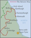
A guide to walking The Reivers Way, through Northumberland, northern England, from Corbridge to Alnmouth for 150 miles (240km) through the wildest parts of Northumberland - the North Pennines, Hadrian’s Wall, Tynedale, Redesdale, the Simonside Hills, Coquetdale and the Cheviot Hills. Includes a national park, AONBs and a fine heritage coast.
Activities
walking, backpacking, trekking, bird-watching (Farne Islands)Seasons
spring can be the most attractive time; in summer accommodation needs to be booked ahead but ferries will be running to the Farne Islands; weather is less reliable in the autumn; in winter some accommodation providers will be closed and walking may be harder (in deep snow or after prolonged rain)Centres
Newcastle-upon-Tyne, Corbridge, Rothbury, Bamburgh, Alnwick, AlnmouthDifficulty
walking is straightforward but sometimes remote and not specifically waymarked so navigation skills are required; terrain is varied; the route is described in 9 day stages but experienced long-distance walkers could tackle it in a weekMust See
North Pennines Area of Outstanding Natural Beauty; Hadrian’s Wall; Northumberland National Park; Cheviot Hills; Northumberland Heritage Coast; Farne Islands; dramatic castles and wild, empty landscapes
Follow in the footsteps of the notorious border ‘reivers’ and discover how they survived centuries of strife and warfare. The Reivers Way wanders for 150 miles (240 kilometres) through the wildest and most scenic parts of Northumberland, taking in the North Pennines, Hadrian’s Wall, Tynedale, Redesdale, the Simonside Hills, Coquetdale and the Cheviot Hills. This wild and sparsely populated landscape includes a national park, areas of outstanding natural beauty and a fine heritage coast.
•nine days with variants and alternative routes, clearly illustrated on OS map extracts
•details of all the services and facilities along the way
•background information on local history and heritage
•includes an optional excursion to the bird reserves of the Farne Islands
Reviews
Geen reviews gevonden voor dit product.
Schrijf een review
Graag horen wij wat u van dit artikel vindt. Vindt u het goed, leuk, mooi, slecht, lelijk, onbruikbaar of erg handig: schrijf gerust alles op! Het is niet alleen leuk om te doen maar u informeert andere klanten er ook nog mee!
Ook interessant voor europa/engeland/north-east-england
-

Wandelgids St. Cuthbert's Way | Ruck
€ 22,50Wandelgidsen North East England -

Wandelkaart - Topografische kaart 08
€ 19,50Topografische kaarten North East England -

Reisgids Wild Guide North East Engla
€ 26,50Reisgidsen North East England -

Wegenkaart - landkaart Pocket Map Pe
€ 7,95Wegenkaarten North East England -

Fietsgids The Coast to Coast Cycle R
€ 23,95Fietsgidsen North East England


