Winkelwagen
Geen items in winkelwagen
Ga naar winkelwagen
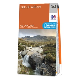
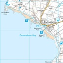
Wandelkaart 361 OS Explorer Map Isle of Arran | Ordnance Survey (9780319263914)
- ISBN / CODE: 9780319263914
- Editie: 01-03-2021
- Aantal blz.: 1
- Schaal: 1:25000
- Uitgever: Ordnance Survey
- Soort: Wandelkaart
- Serie: OS Explorer Map
- Taal: Engels
- Hoogte: 23.0 cm
- Breedte: 13.0 cm
- Gewicht: 94.0 g
- Bindwijze: -
- Uitvoering: Papier
- Schrijf als eerste een review
-
€ 19,50
Leverbaar in 3 - 5 werkdagen in huis in Nederland Levertijd Belgie
Gratis verzending in Nederland vanaf €35,-
-
Overzichtskaart Explorer 25.000 wandelkaarten Zuid Schotland - Borders

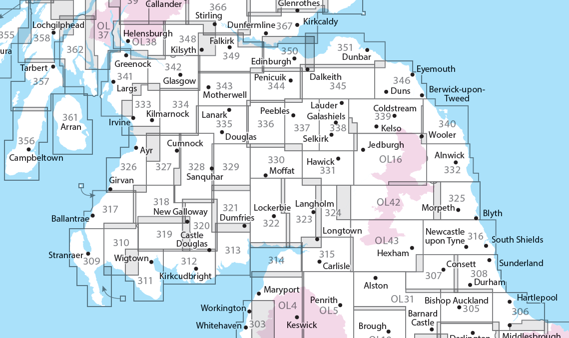
Producten op deze overzichtskaart:
Klik op een product om naar de pagina van dat product te gaan.
- Wandelkaart - Topografische kaart 307 OS Explorer Map Consett, Derwent reservoir | Ordnance Survey
- Wandelkaart - Topografische kaart 308 OS Explorer Map Durham, Sunderland | Ordnance Survey
- Wandelkaart - Topografische kaart 309 OS Explorer Map Stranraer & The Rhins | Ordnance Survey
- Wandelkaart - Topografische kaart 310 OS Explorer Map Glenluce, Kirkcowan | Ordnance Survey
- Wandelkaart - Topografische kaart 311 OS Explorer Map Wigtown, Whithorn, The Machars | Ordnance Survey
- Wandelkaart - Topografische kaart 312 OS Explorer Map Kirkcudbright, Castle Douglas | Ordnance Survey
- Wandelkaart - Topografische kaart 313 OS Explorer Map Dumfries, Dalbeattie | Ordnance Survey
- Wandelkaart - Topografische kaart 314 OS Explorer Map Solway Firth, Wigton, Silloth explorer | Ordnance Survey
- Wandelkaart - Topografische kaart 315 OS Explorer Map Carlisle, Brampton, Longtown, Gretna Green | Ordnance Survey
- Wandelkaart - Topografische kaart 316 OS Explorer Map Newcastle upon Tyne | Ordnance Survey
- Wandelkaart - Topografische kaart 317 OS Explorer Map Ballantrae, Barr & Barrhill | Ordnance Survey
- Wandelkaart - Topografische kaart 318 OS Explorer Map Galloway Forest Park North | Ordnance Survey
- Wandelkaart - Topografische kaart 319 OS Explorer Map Galloway Forest Park South | Ordnance Survey
- Wandelkaart - Topografische kaart 320 OS Explorer Map Castle Douglas, Loch Ken, New Galloway | Ordnance Survey
- Wandelkaart - Topografische kaart 321 OS Explorer Map Nithsdale, Dumfries | Ordnance Survey
- Wandelkaart - Topografische kaart 322 OS Explorer Map Annandale | Ordnance Survey
- Wandelkaart - Topografische kaart 323 OS Explorer Map Eskdale, Castle O'er Forest | Ordnance Survey
- Wandelkaart - Topografische kaart 324 OS Explorer Map Liddesdale, Kershope Forest | Ordnance Survey
- Wandelkaart - Topografische kaart 325 OS Explorer Map Morpeth, Blyth | Ordnance Survey
- Wandelkaart - Topografische kaart 326 OS Explorer Map Ayr, Troon | Ordnance Survey
- Wandelkaart - Topografische kaart 327 OS Explorer Map Cumnock, Dalmellington | Ordnance Survey
- Wandelkaart - Topografische kaart 328 OS Explorer Map Sanquhar, New Cumnock | Ordnance Survey
- Wandelkaart - Topografische kaart 329 OS Explorer Map Lowther Hills, Sanquhar, Leadhills | Ordnance Survey
- Wandelkaart - Topografische kaart 330 OS Explorer Map Moffat, St Mary's Loch | Ordnance Survey
- Wandelkaart - Topografische kaart 331 OS Explorer Map Teviotdale South | Ordnance Survey
- Wandelkaart - Topografische kaart 332 OS Explorer Map Alnwick, Amble | Ordnance Survey
- Wandelkaart - Topografische kaart 333 OS Explorer Map Kilmarnock, Irvine | Ordnance Survey
- Wandelkaart - Topografische kaart 334 OS Explorer Map East Kilbride, Galston, Darvel | Ordnance Survey
- Wandelkaart - Topografische kaart 335 OS Explorer Map Lanark, Tinto Hills | Ordnance Survey
- Wandelkaart - Topografische kaart 336 OS Explorer Map Biggar, Broughton | Ordnance Survey
- Wandelkaart - Topografische kaart 337 OS Explorer Map Peebles, Interleithen | Ordnance Survey
- Wandelkaart - Topografische kaart 338 OS Explorer Map Galashiels, Selkirk, Melrose | Ordnance Survey
- Wandelkaart - Topografische kaart 339 OS Explorer Map Kelso, Coldstream, Lower Tweed Valley | Ordnance Survey
- Wandelkaart - Topografische kaart 340 OS Explorer Map Holy Island, Bamburgh | Ordnance Survey
- Wandelkaart - Topografische kaart 341 OS Explorer Map Greenock, Largs, Millport | Ordnance Survey
- Wandelkaart - Topografische kaart 342 OS Explorer Map Glasgow | Ordnance Survey
- Wandelkaart - Topografische kaart 343 OS Explorer Map Motherwell, Coatbridge | Ordnance Survey
- Wandelkaart - Topografische kaart 344 OS Explorer Map Pentland Hills | Ordnance Survey
- Wandelkaart - Topografische kaart 345 OS Explorer Map Lammermuir Hills | Ordnance Survey
- Wandelkaart - Topografische kaart 346 OS Explorer Map Berwick-upon-Tweed | Ordnance Survey
- Wandelkaart - Topografische kaart 349 OS Explorer Map Falkirk, Cumbernauld, Livingston | Ordnance Survey
- Wandelkaart - Topografische kaart 350 OS Explorer Map Edinburgh | Ordnance Survey
- Wandelkaart - Topografische kaart 351 OS Explorer Map Dunbar, North Berwick | Ordnance Survey
- Wandelkaart 361 OS Explorer Map Isle of Arran | Ordnance Survey
- Wandelkaart - Topografische kaart 361 OS Explorer Map | Active Isle of Arran | Ordnance Survey
- Wandelkaart - Topografische kaart 362 OS Explorer Map Cowal West, Isle of Bute | Ordnance Survey
- Wandelkaart - Topografische kaart OL16 OS Explorer Map Cheviot Hills | Ordnance Survey
- Wandelkaart - Topografische kaart OL42 OS Explorer Map Kielder Water & Forest | Ordnance Survey
- Wandelkaart - Topografische kaart OL43 OS Explorer Map Hadrian's Wall | Ordnance Survey
-
Overzichtskaart Explorer 25.000 wandelkaarten Zuidwest Schotland - Loch Lomond
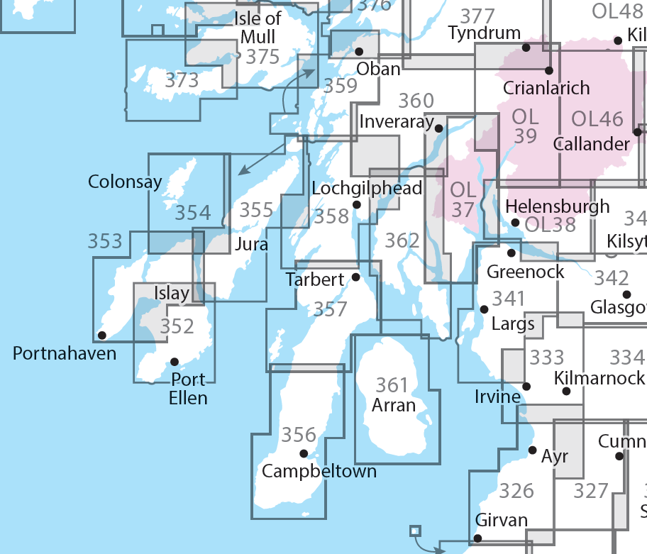
Producten op deze overzichtskaart:
Klik op een product om naar de pagina van dat product te gaan.
- Wandelkaart - Topografische kaart 326 OS Explorer Map Ayr, Troon | Ordnance Survey
- Wandelkaart - Topografische kaart 327 OS Explorer Map Cumnock, Dalmellington | Ordnance Survey
- Wandelkaart - Topografische kaart 333 OS Explorer Map Kilmarnock, Irvine | Ordnance Survey
- Wandelkaart - Topografische kaart 341 OS Explorer Map Greenock, Largs, Millport | Ordnance Survey
- Wandelkaart - Topografische kaart 342 OS Explorer Map Glasgow | Ordnance Survey
- Wandelkaart - Topografische kaart 352 OS Explorer Map Islay South | Ordnance Survey
- Wandelkaart - Topografische kaart 353 OS Explorer Map Islay North | Ordnance Survey
- Wandelkaart - Topografische kaart 354 OS Explorer Map Colonsay, Oronsay | Ordnance Survey
- Wandelkaart - Topografische kaart 355 OS Explorer Map | Active Jura, Scarba | Ordnance Survey
- Wandelkaart - Topografische kaart 355 OS Explorer Map Jura, Scarba | Ordnance Survey
- Wandelkaart - Topografische kaart 356 OS Explorer Map Kintyre South | Ordnance Survey
- Wandelkaart - Topografische kaart 357 OS Explorer Map Kintyre North | Ordnance Survey
- Wandelkaart - Topografische kaart 358 OS Explorer Map Lochgilphead, Knapdale North | Ordnance Survey
- Wandelkaart - Topografische kaart 359 OS Explorer Map Oban, Kerrera, Loch Melfort | Ordnance Survey
- Wandelkaart - Topografische kaart 360 OS Explorer Map Loch Awe, Inveraray | Ordnance Survey
- Wandelkaart - Topografische kaart 361 OS Explorer Map | Active Isle of Arran | Ordnance Survey
- Wandelkaart 361 OS Explorer Map Isle of Arran | Ordnance Survey
- Wandelkaart - Topografische kaart 362 OS Explorer Map Cowal West, Isle of Bute | Ordnance Survey
- Wandelkaart - Topografische kaart 373 OS Explorer Map Iona, Staff, Ross of Mull | Ordnance Survey
- Wandelkaart - Topografische kaart 373 OS Explorer Map | Active Iona, Staffa, Ross of Mull | Ordnance Survey
- Wandelkaart - Topografische kaart 374 OS Explorer Map Isle of Mull North, Tobermroy | Ordnance Survey
- Wandelkaart - Topografische kaart 375 OS Explorer Map Isle of Mull East | Ordnance Survey
- Wandelkaart - Topografische kaart 377 OS Explorer Map Loch Etive, Glen Orchy Explorer | Ordnance Survey
- Wandelkaart - Topografische kaart OL37 OS Explorer Map Cowal East | Ordnance Survey
- Wandelkaart - Topografische kaart OL38 OS Explorer Map Loch Lomond South | Ordnance Survey
- Wandelkaart - Topografische kaart OL39 OS Explorer Map Loch Lomond North | Ordnance Survey
- Wandelkaart - Topografische kaart OL46 OS Explorer Map The Trossachs | Ordnance Survey
- Wandelkaart - Topografische kaart OL48 OS Explorer Map Ben Lawers & Glen Lyon | Ordnance Survey
Overzichtskaarten
Beschrijving
Van de uitgever
Met zijn 4cm voor 1 km (2 ½ cm voor 1 mijl) schaal, is de OS Explorer kaartenserie de ideale en meest gedetailleerde kaartenreeks voor mensen die graag outdoor-activiteiten zoals fietsen, wandelen, paardrijden, klimmen en watersporten.
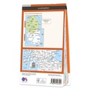
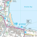
Deze kaart is nog gedetailleerder dan de 'gewone' Landranger maps. Voor- en achterzijde bedrukt! Zeker op de moors en andere natuurgebieden van onschatbare waarden met echt alle aspecten van het landschap op de kaart ingetekend. Zeer goede detailkaart met topografische ondergrond. Hierop zijn toeristische symbolen van bezienswaardigheden ingetekend, daarnaast staan bijvoorbeeld campings en jeugdherbergen vermeld en - voor wandelaars het belangrijkst - alle right of way paden en Lange afstands Wandelpaden zijn er op te vinden. De ideale kaart voor het wandelen in Engeland, Wales of Schotland.
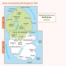
Experience ‘Scotland in miniature’ on the Isle of Arran, with its rocky, wild highlands in the north and lush lowlands in the south. Climb Goat Fell, the highest point on the Isle of Arran, for spectacular panoramic views or explore the mysterious standing stones on Machrie Moor.
Take the Arran Coastal Way to discover the King’s Cave in the sandstone cliffs and the beaches of Blackwaterfoot
Visit Brodick Castle, with its subline views across to the Ayrshire coast, or take a boat to Holy Isle with its ancient spiritual heritage and unspoiled beauty
Walk, hike or cycle along the Arran Coastal Path, climb jagged summits and rocky ridges and glimpse red squirrels, red deer, golden eagles and otters
Dit product heeft meerdere varianten:

