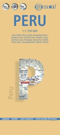
Mooie geplasticieerde kaart van Peru. Deze kaart biedt een goed overzicht van het land met detailkaarten.
Our soft-laminated folded map of Peru shows: Peru North 1:1 750 000, Peru South 1:1 750 000, Amazonian Peru 1:2 500 000, Central Lima 1:18 000, Greater Lima 1:150 000, Central Cuzco 1:12 000, Greater Cuzco 1:50 000, Ayacucho 1:20 000, Arequipa 1:17 000, Chan Chan 1:40 000, Trujillo 1:20 000, Sacsayhuaman 1:10 000, Machu Picchu 1:44 000, Peru administrative & time zones. Borch Maps are easy to fold, durable and water-repellent with a wipeable surface. Borch Maps show hotels, museums, monuments, markets, public transport, top sights and points of interest, useful statistics, conversion charts for temperatures, weights and measurements, climate charts showing temperatures, sunshine hours, precipitation and humidity, overview maps, time zones, and much more...
Bordering Brazil, Bolivia, Chile, Colombia, Ecuador and the Pacific Ocean, the Republic of Peru is the cradle of the Inca empire. Peru is home to many parks, reservations and sanctuaries, unique flora and fauna, tropical jungles, the highest lake in the world, several deserts, a rich cultural heritage, as well as being noted for its unique art, literature, music and folklore. Just 100 kilometers inland, the Andes rise up to 6,000 meters (18,000 feet), their jagged ranges separated by deep canyons. Descending the eastern slopes, the rich cloud forests transform into the rainforest of the Amazon Basin. Mountaineers can try their luck around Huarez and the former Inca capital Cuzco; wildlife enthusiasts will be entertained by the sea lions on the Islas Ballestas near Pisco; culture and history buffs will be able to feast on Peru's archeological wealth and charming colonial cities; Chan Chan - the huge adobe capital of the Chimu (near Trujillo); the 2,500 year old Chavín ruins near Huarez; the beautiful cities of Arequipa and Cajamarca. The ultimate experience, however, is walking the famous Inca Trail, which leads through spectacular mountain scenery and past mysterious ancient ruins, until the path descends to Peru's icon - legendary Machu Picchu - detailed on our map.


