Kaarten
De beste wegenkaarten, routekaarten, fiets- of wandelkaarten en topografische kaarten vindt u hier!
 Wegenatlas Italien - Italie | A4 | Ringband | Marco Polo
Mooie wegenatlas van Marco Polo van Italie. Veel detail met wegenummers, onderscheid in verschillende wegen, afstanden tussen dorpen en steden. Ook bezienswaardigheden en andere toeristische aspecten staan met symbolen ingetekend. …
 Fietskaart ADFC Regionalkarte Provinz Limburg - provincie Limburg | BVA BikeMedia
Gedetailleerde fietskaart van een klein gebied: de provincie Limburg van helemaal van het noord naar zuid. Echte fietskaart, dus alle relevants als knooppunten, bewegwijzerde routes, hellingen, campings etc zijn natuurlijk …
 Wandelkaart 659 Gardasee Nord - Gardameer noord | Kompass
Plaatsen op de kaart: Riva del Garda - Arco - Fiave - Torbole - Malcesine - Mont Baldo Nord - Ledro - Limone sul Garda Goede wandelkaart met vrijwel …
 Wandelkaart 824 Biosphärenreservat Bliesgau & Saarpfalz-Kreis | Kompass
Belangrijke plaatsen op de kaart: Saarbrücken - Zweibrücken - Kirkel - Bleisbruck - Homburg Goede wandelkaart met vrijwel alle topografische details als hoogtelijnen, vegetatie, schaduwtekening maar ook de ingetekende …
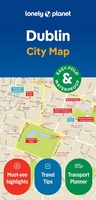 Stadsplattegrond City map Dublin | Lonely Planet
Durable and waterproof, with a handy slipcase and an easy-fold format, Lonely Planet's Dublin City Map is your conveniently sized passport to travelling with ease. With this easy-to-use, full-colour navigation …
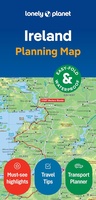 Wegenkaart - landkaart Planning Map Ireland | Lonely Planet
Durable and waterproof, with a handy slipcase and an easy-fold format, Lonely Planet's Ireland Planning Map is your essential navigation tool. This full-colour map features accompanying images and information …
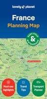 Wegenkaart - landkaart Planning Map France | Lonely Planet
Durable and waterproof, with a handy slipcase and an easy-fold format, Lonely Planet's France City Map is your conveniently sized passport to travelling with ease. Get more from your map …
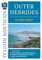 Wegenkaart - landkaart in your pocket Outer Hebrides | Nicolson
The Outer Hebrides In Your Pocket is our new essential map for visiting these beautiful islands. Exceptionally clear road mapping of the Outer Hebrides shows main tourist attractions, EV charge …
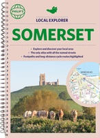 Wegenatlas Local Explorer Street Atlas Somerset | Philip's Maps
Prachtige wegenatlas van Somerset voor fietsers en wandelaars op een super gedetaileerde schaal! Met Lange afstandsfietsroutes en wandelroutes. Who hasn't explored and enjoyed their surrounding area recently and come …
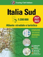 Opruiming - Wegenatlas Atlante stradale Italia Sud - Italie zuid | Touring Club Italiano
opruiming = oude druk, van 24.95 voor 10.00 Gebied van Rome naar het zuiden tot en met Sicilie, groter dan A4 formaat Het is de Touring-atlas bij uitstek, de meest …
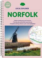 Wegenatlas Local Explorer Street Atlas Norfolk | Philip's Maps
Who hasn't explored and enjoyed their surrounding area in recent years and come to appreciate what is on our respective doorsteps? Philip's have created this new series for walkers, cyclists …
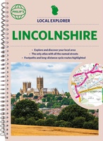 Wegenatlas Local Explorer Street Atlas Lincolnshire | Philip's Maps
Who hasn't explored and enjoyed their surrounding area recently and come to appreciate what is on our respective doorsteps? Philip's have created this new series for walkers, cyclists and local …
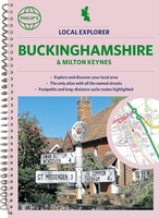 Wegenatlas Local Explorer Street Atlas Buckinghamshire and Milton Keynes | Philip's Maps
Philip's created this new series for walkers, cyclists and local explorers at a scale that provides greener options to uncover all the nature and hidden gems in your local area. …
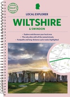 Wegenatlas Local Explorer Street Atlas Wiltshire and Swindon | Philip's Maps
Who hasn't explored and enjoyed their surrounding area in recent years and come to appreciate what is on our respective doorsteps? Philip's have created this new series for walkers, cyclists …
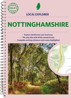 Wegenatlas Local Explorer Street Atlas Nottinghamshire | Philip's Maps
Philip's created this new series for walkers, cyclists and local explorers at a scale that provides greener options to uncover all the nature and hidden gems in your local area. …
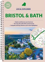 Wegenatlas Local Explorer Street Atlas Bristol and Bath | Philip's Maps
Who hasn't explored and enjoyed their surrounding area recently and come to appreciate what is on our respective doorsteps? Philip's have created this new series for walkers, cyclists and local …
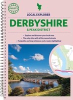 Wegenatlas Local Explorer Street Atlas Derbyshire and the Peak District | Philip's Maps
Who hasn't explored and enjoyed their surrounding area in recent years and come to appreciate what is on our respective doorsteps? Philip's have created this new series for walkers, cyclists …
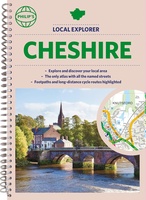 Wegenatlas Local Explorer Street Atlas Cheshire | Philip's Maps
Who hasn't explored and enjoyed their surrounding area recently and come to appreciate what is on our respective doorsteps? Philip's have created this new series for walkers, cyclists and local …
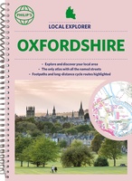 Wegenatlas Local Explorer Street Atlas Oxfordshire | Philip's Maps
Who hasn't explored and enjoyed their surrounding area in recent years and come to appreciate what is on our respective doorsteps? Philip's have created this new series for walkers, cyclists …
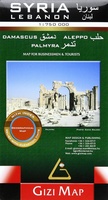 Wegenkaart - landkaart Syria and Libanon - Syrië | Gizi Map
Geographical map of Syria and Lebanon edited by Gizi Map. This detailed map presents topography, country road infrastructure and oil / gas pipelines. It includes inserts in the area of …
Laatste reviews

Niet echt voor beginners. Ook zijn de routes soms moeilijk qua logistiek. Weer terugkomen aan het eind bv. En in voorseizoen (mei) blijft er niet …
★★★★★ door Tjeerd 17 mei 2024 | Heeft dit artikel gekocht
Van te voren had ik een andere kaart op het oog. Toen ik in de winkel was adviseerde zij mij deze kaart. Op hun verzoek …
★★★★★ door Koen 17 mei 2024 | Heeft dit artikel gekocht
Ideale schaal waar ook de kleinere wegen duidelijk zijn aangegeven. Beschrijving op website is correct.
★★★★★ door Peter 16 mei 2024 | Heeft dit artikel gekocht
Overzichtelijke kaart. Niks op aan te merken.
★★★★★ door Bastiaan de Leeuw 16 mei 2024 | Heeft dit artikel gekocht