National Geographic
Dit bekende tv-kanaal heeft naast prachtige natuurdocumontaires en magazines ook zijn eigen reisgidsen en wegenkaarten uitgegeven. De landkaarten zijn gedrukt op scheurvast en waterbestendig papier wat een vergrootte levensduur betekent. De kaarten zijn helder en bevatten een schat aan informatie voor zowel de 'gewone' toerist als de avonturier. De hoofdwegen zijn duidelijk aangegeven, maar ook de secundaire wegen en tracks staan er op. Met de nationale parken duidelijk en mooie zwemplekken of attracties aangegeven onderscheidt deze kaartenserie zich van de andere wegenkaarten. De kaarten heten dan ook niet voor niets Adventure Maps! Het avontuur wacht!
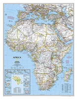 Wandkaart Afrika, politiek, 91 x 118 cm | National Geographic
Mooie wandkaart van Afrika, staatkundig, met rustig kleurgebruik en helder kaartbeeld, Ondanks het wat kleiner formaat staan er toch heel wat topografische details op vermeld. The map presents Africa …
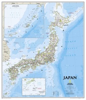 Wandkaart Japan, 63 x 74 cm | National Geographic
This classic-style map of Japan shows political boundaries, major highways and roads, cities and towns, airports, and other geographic details. Thousands of place-names and exact borders are carefully researched by …
 Wandkaart Afrika, politiek, 61 x 78 cm | National Geographic
Mooie wandkaart van Afrika, staatkundig, met rustig kleurgebruik en helder kaartbeeld, Ondanks het wat kleiner formaat staan er toch heel wat topografische details op vermeld. Kaart is up-to-date, alleen …
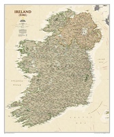 Wandkaart Ierland, antiek, 76 x 92 cm | National Geographic
National Geographic Maps' new Ireland wall map is one of the most authoritative maps yet published of the Emerald Isle. Of the nearly 1,000 place-names shown on this map, all …
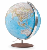 Wereldbol - Globe Fusion Classic Ø 37 cm | National Geographic
Fusion 3703 Classic, grote verlichte wereldbol met modern ontwerp van National Geographic Cartography (politiek, zeeën in blauw). Traditionele handlaminering, meridiaan en voet van geborsteld roestvrij staal. Inclusief spaarlamp, transparante kabel …
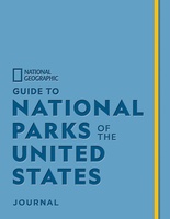 Reisgids Guide to National Parks of the United States Journal | National Geographic
Fans of National Geographic’s guides to the National Parks will flock to create a bucket list of their own in this one-of-a-kind journal. The companion to Guide to the National …
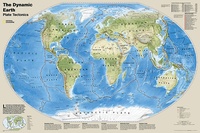 Wereldkaart Dynamic earth plate tectonics, 92 x 61 cm | National Geographic
The new Dynamic Earth wall map illustrates plate tectonics and features new bathymetry and naturally colored relief, as well as current volcano and earthquake data. Notable earthquakes and eruptions lists …
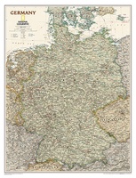 Wandkaart Duitsland, antiek, 60 x 77 cm | National Geographic
Complete political actual detail of Germany - country boundaries, roads and cities, airports, bodies of water, and other geographic details in antique style.
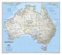 Wandkaart Australië, politiek, 77 x 69 cm | National Geographic
Highly accurate Australia political map clearly shows state boundaries, place names, bodies of water, parks and preserves, and more. Includes inset maps for Tasmania and major Australian cities. This version …
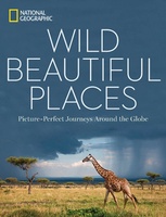 Fotoboek Wild, Beautiful Places | National Geographic
National Geographic photography captures the world's most remote, exotic places in this visually stunning travel book full of scenic wonders to experience. Highlighting 50 of Earth's most pristine, scenic locales, …
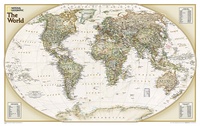 Wereldkaart Politiek & antiek, 82 x 51 cm | National Geographic
The World Explorer Executive uses the Winkel-Tripel Map Projection, which strikes the best balance of accuracy, aesthetics, and proportion, eliminating the issue found in many other maps where Greenland appears …
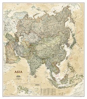 Wandkaart Azië, politiek & antiek, 84 x 96 cm | National Geographic
Mooie wandkaart van Azië, staatkundig, met rustig kleurgebruik en helder kaartbeeld; deze kaart heeft een antieke uitstraling door gebruik van aarde-kleuren. Ondanks het wat kleine formaat staan er toch heel …
 Sterrenkaart - Planisfeer Sterrenhemel - noordelijk halfrond | National Geographic
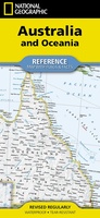 Wegenkaart - landkaart Australia and Oceania | National Geographic
• Waterproof • Tear-Resistant • Reference Map Expertly researched and designed, National Geographic's Australia and Oceania Flags & Facts Map is the authoritative map of Australia by which other …
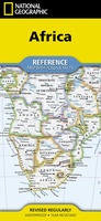 Wegenkaart - landkaart Africa - Afrika | National Geographic
• Waterproof • Tear-Resistant • Reference Map Expertly researched and designed, National Geographic's Africa Flags & Facts Map is the authoritative map of Africa by which other reference …
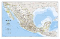 Wandkaart Mexico, 78 x 54 cm | National Geographic
Decoratieve wandkaart van Mexico. Naast de mooie kleuren staan er bijzonder veel plaatsen op vermeld. This finely detailed National Geographic political map of Mexico shows country boundaries, cities and towns, …
★★★★★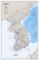 Wandkaart Korean Peninsula Noord- en Zuid Korea, 59 x 91 cm | National Geographic
Amid increasingly combative rhetoric from Pyongyang, North Korea, do you know where its underground nuclear test site or missile launch centers are located? Are you aware that the South Korean …
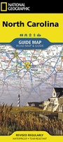 Wegenkaart - landkaart State Guide Map North Carolina | National Geographic
Makkelijk leesbare kaart aan 2 zijden bedrukt. De ene kan met informatie en beperkte stadsplattegronden, de andere met de daadwerkelijke kaart. De kaart is geplastificeerd en dus watervast! The front …
★★★★★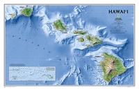 Wandkaart Hawaii, 88 x 58 cm | National Geographic
One of our most visually stunning maps, the Hawaii Physical Map shows all eight of the major islands and includes an inset of the entire chain of reefs stretching nearly …
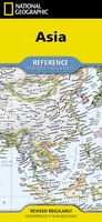 Wegenkaart - landkaart Asia - Azië | National Geographic
• Waterproof • Tear-Resistant • Reference Map Expertly researched and designed, National Geographic's Asia Flags & Facts Map is the authoritative map of Asia by which other reference maps …
Laatste reviews

Heb de gids cadeau gedaan en die persoon was er heel blij mee ..
★★★★★ door J 21 november 2024 | Heeft dit artikel gekocht
De kaart van Kirgystan is prachtig, zeer gedetailleerd. Kan niet wachten tot de we echt op reis hmgaan die kant op.
★★★★★ door Marijke Eering 21 november 2024 | Heeft dit artikel gekocht
Super handig fiets boekje en mooi water bestendig. En handig om op de kaarten te kijken heel duidelijk beschrijving. Wij fietsen al jaren in Duitsland …
★★★★★ door Jenneke holterman 19 november 2024 | Heeft dit artikel gekocht
prima kaart levering en betaling allemaal vlot verlopen
★★★★★ door Marc Buts 19 november 2024 | Heeft dit artikel gekocht