South East England
 Wandelkaart - Topografische kaart 159 OS Explorer Map Reading, Wokingham & Pangbourne Map | Thames Path | Ordnance Survey
Experience everything Reading has to offer and discover the charms of Wokingham and of Pangbourne, an idyllic waterside town on the River Thames among the gorgeous North Wessex Downs. Follow …
 Wandelkaart - Topografische kaart 160 OS Explorer Map Windsor, Weybridge, Bracknell | Thames Path | Ordnance Survey
Follow the Thames Path through Windsor, home to the world’s largest and oldest inhabited castle, to Egham, Staines and Weybridge with its motoring and aviation museums. Walk in the footsteps …
 Wandelkaart - Topografische kaart 161 OS Explorer Map London South (greenw.m) | Ordnance Survey
Follow the Thames Path through the heart of London’s oldest and most historic areas. Discover Westminster, a square mile densely packed with some of the world’s most famous attractions: Buckingham …
 Wandelkaart - Topografische kaart 162 OS Explorer Map Greenwich, Gravesend | Ordnance Survey
Consider yourself at home as you explore London's East End, a byword for cheeky Cockneys, gruesome murders and political activism. See the Thames in a new light in Greenwich, where …
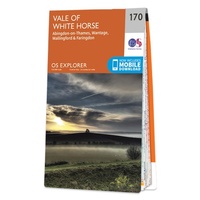 Wandelkaart - Topografische kaart 170 OS Explorer Map Abingdon, Wantage & Vale of White Horse | Ordnance Survey
Discover the Vale of White Horse, rolling hills dominated by the extraordinary, eponymous White Horse, an enigmatic Bronze Age chalk carving which can be seen for miles leaping across the …
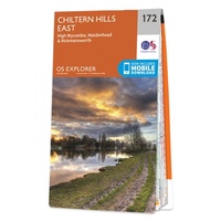 Wandelkaart - Topografische kaart 172 OS Explorer Map Chiltern Hills East | Ordnance Survey
Discover the east Chiltern Hills where they meet the Thames Valley, replete with lovely countryside, beautiful views and rich history. Delight in the unrivalled sailing reaches of Maidenhead; the Georgian …
★★★★★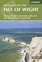 Wandelgids Walking on the Isle of Wight | Cicerone
34 walking routes on the beautiful Isle of Wight, ranging in difficulty from easy to strenuous and from 4 to 16 miles long. The routes are suitable for all abilities …
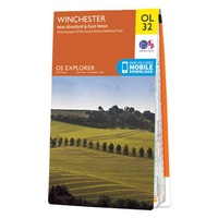 Wandelkaart - Topografische kaart OL32 OS Explorer Map Winchester | Ordnance Survey
Met zijn 4cm voor 1 km (2 ½ cm voor 1 mijl) schaal, is de OS Explorer kaartenserie de ideale en meest gedetailleerde kaartenreeks voor mensen die graag outdoor-activiteiten zoals …
 Wandelkaart - Topografische kaart OL33 OS Explorer Map Haslemere & Petersfield | Ordnance Survey
Met zijn 4cm voor 1 km (2 ½ cm voor 1 mijl) schaal, is de OS Explorer kaartenserie de ideale en meest gedetailleerde kaartenreeks voor mensen die graag outdoor-activiteiten zoals …
 Reisgids Marco Polo NL Zuid England | 62Damrak
Marco Polo reisgids voor Zuid-Engeland. Handig pocketformaat, boordevol informatie, met uitneembare kaart achter in het boek en atlas-pagina’s. Met Insider Tips om de échte stad/streek te ontdekken en de TOP …
 Wandelgids Walking the North Downs Way Map Booklet | Cicerone
All the mapping you need to walk the 130 mile (208km) North Downs Way National Trail between Farnham and Dover. One of the easier National Trails, it can be comfortably …
 Wandelgids Thames Path | Trailblazer Guides
This book follows the Thames Path National Trail from the river's source in Gloucestershire to the Thames Barrier in London. Officially 184 miles (294km) in length (although the actual distance …
 Wandelgids 66 Pathfinder Guides West Sussex and the South Downs National Park | Ordnance Survey
Wandelgids van een deel van Engeland. Deze gids bevat 28 dagwandelingen, variërend van korte tochten tot pittige dagtochten. De bijbehorende kaarten zijn uitstekend: men heeft de topografische kaarten van Ordnance …
 Fietsgids 20 Classic Sportives - South East England | Cicerone
This guidebook offers 20 sportive cycling routes in the best cycling areas of south east England. The training rides range between 60 and 117km (37 to 73 miles) in length, …
 Reisgids Eyewitness Travel England's South Coast - Zuid Engeland | Dorling Kindersley
Prachtig geillustreerde reisgids met o.a. 3D tekeningen, fraaie kaarten en geweldige foto’s. Daarnaast uitgebreide achtergrondbeschrijvingen. Echt om in de stemming te komen! Groot formaat gids. Engelstalig Taking you from Kent …
 Wandelkaart - Topografische kaart OL34 OS Explorer Map Crawley & Horsham | Ordnance Survey
Met zijn 4cm voor 1 km (2 ½ cm voor 1 mijl) schaal, is de OS Explorer kaartenserie de ideale en meest gedetailleerde kaartenreeks voor mensen die graag outdoor-activiteiten zoals …
★★★★★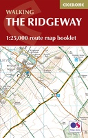 Wandelatlas Ridgeway Map Booklet | Cicerone
Heel handig bedacht van uitgever Cicerone: een boekje dat dienst doet als atlas met alle topografische kaarten die je nodig hebt voor het lopen van de Ridgeway. Past goed in …
 Reisgids Brighton, Sussex & the South Downs | Rough Guides
Een kleinere versie in zakformaat van de grotere versies van de Rough Guides. Als altijd weer vol met goede informatie over cultuur en praktische zaken. Voorin een kaart van de …
 Reisgids Slow Travel Isle of Wight | Bradt Travel Guides
Een bijzondere serie van Bradt guides, waarin een gedeelte van Engeland uitgebreid beschreven wordt. Met veelv aandacht voor kleine details die je niet ao gauw elders zult vinden. Naast de …
★★★★★ Reisgids England | Reise Know-How Verlag
Der Reiseführer für den Süden Englands von Reise Know-How - umfassend, engagiert und aktuell: Folgen Sie den Autoren nach Südengland und erleben Sie wunderschöne Gärten und historische Herrschaftshäuser. Entdecken Sie …
Laatste reviews

Niet echt voor beginners. Ook zijn de routes soms moeilijk qua logistiek. Weer terugkomen aan het eind bv. En in voorseizoen (mei) blijft er niet …
★★★★★ door Tjeerd 17 mei 2024 | Heeft dit artikel gekocht
Van te voren had ik een andere kaart op het oog. Toen ik in de winkel was adviseerde zij mij deze kaart. Op hun verzoek …
★★★★★ door Koen 17 mei 2024 | Heeft dit artikel gekocht
Ideale schaal waar ook de kleinere wegen duidelijk zijn aangegeven. Beschrijving op website is correct.
★★★★★ door Peter 16 mei 2024 | Heeft dit artikel gekocht
Overzichtelijke kaart. Niks op aan te merken.
★★★★★ door Bastiaan de Leeuw 16 mei 2024 | Heeft dit artikel gekocht