Kaarten - Wales
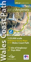 Wandelkaart Wales Coast Path: Isle of Anglesey | Northern Eye Books
Enhanced, large scale (1: 25,000) Ordnance Survey mapping in a handy atlas format with all the mapping you need to walk a complete circuit of the Anglesey section of the …
 Wegenkaart - landkaart Wales & south of England - Zuid Engeland | ITMB
Een degelijke kaart met aanduidingen van o.a. nationale parken, vliegveld, benzinepompen. We are gradually increasing the scales for our data of Great Britain and this is our latest effort. Most …
★★★★★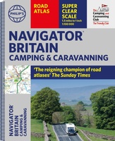 Wegenatlas Navigator Camping and Caravanning – Atlas of Britain | Philip's Maps
THE MUST-HAVE ATLAS OF BRITAIN FOR CAMPING, CARAVANNING AND MOTORHOMES'A map that beats all others' - The Daily Telegraph'Scale, accuracy and clarity are without parallel' - Driving Magazine'No. 1 in …
★★★★★ Wandelkaart Glyndwr's Way | Harvey Maps
XT40. Leap forward in technical excellence. Tough, light and 100% waterproof Compact and light - the map itself weighs just 60gms - a third of the weight of a …
 Wandelkaart Anglesey Coastal Path | Harvey Maps
Een bijzonder handige kaart van dit lange-afstands-wandelpad. Op waterafstotend papier met veel details. Het enige dat je eigenlijk een beetje mist is een overzicht. Verder uitstekend en voldoende voor de …
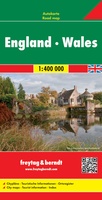 Wegenkaart - landkaart Engeland - Wales | Freytag & Berndt
Gedetailleerde, tweezijdige landkaart van Engeland en Wales op schaal 1:400.000, prima geschikt voor planning en rondtrekken. De berijdbare wegen zijn goed weergeven, zowel de hoofdwegen als provinciale en lokale wegen; …
★★★★★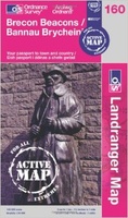 Wandelkaart 160 Landranger Active Brecon Beacons | Ordnance Survey
Zeer goede detailkaart met topografische ondergrond. Hierop zijn toeristische symbolen van bezienswaardigheden ingetekend, daarnaast staan bijvoorbeeld campings en jeugdherbergen vermeld en - voor wandelaars het belangrijkst - alle right of …
 Wegenkaart - landkaart Wales & southwest England | ITMB
Een degelijke kaart met aanduidingen van o.a. nationale parken, vliegveld, benzinepompen. Finally, we have been able to create our own map of the lovely country of Wales. I use the …
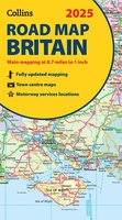 Wegenkaart - landkaart Road Map of Britain 2025 | Collins
Full-colour, double-sided road map of Great Britain at a scale of 8.7 miles to 1 inch. Northern England, Scotland and the Isle of Man are on one side with Southern …
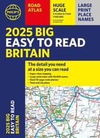 Wegenatlas Philip's Easy to Read Road Atlas of Britain 2025 | A3-Formaat | Paperback | Philip's Maps
With the detail you need at a size you can read, the latest edition of 2025 Philip's Big Easy to Read Road Atlas of Britain is super-clear, super-sized and bang …
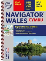 Wegenatlas Wales Navigator | A4 | Ringband | Philip's Maps
Ideaal voor fietsers! Explore the many attractions of Wales with this easy-to-use road atlas showing all the top spots. Easy-to-read mapping, superb extra detail, and a great lie-flat format make …
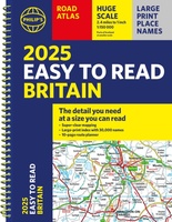 Wegenatlas Philip's Easy to Read Road Atlas of Britain 2025 | A4-Formaat | Ringband | Philip's Maps
"The detail you need at a size you can read". The latest 2025 Philip's Easy to Read Road Atlas of Britain from the best-selling Road Atlas range has over 350 …
 Wandelkaart Snowdonia Noord | Harvey Maps★★★★★
 Wandelkaart Wales Coast Path 2 | Harvey Maps
 Wandelkaart Wales Coast Path 3 | Harvey Maps
 Wandelkaart Wales Coast Path 1 | Harvey Maps
 Wandelkaart Wales Coast Path 4 | Harvey Maps
 Wandelkaart Snowdonia Zuid | Harvey Maps
 Wandelkaart Snowdonia Central | Harvey Maps
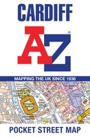 Stadsplattegrond Pocket Street Map Cardiff | A-Z Map Company
Navigate your way around Leeds with detailed street maps from A-Z This up-to-date, folded A-Z street map includes all of the 2,100 streets in and around Blackpool. As well as …
Laatste reviews

Mooie landkaart en snel bezorgd
★★★★★ door Rene van Paasen 16 december 2024 | Heeft dit artikel gekocht
Als er één ding is waardoor de Blue Guides bekendheid genieten, dan is het wel de vele aandacht voor cultuur. Zo ook deze. Ik krijg …
★★★★★ door Christine Grit 13 december 2024 | Heeft dit artikel gekocht
De coördinaten op de kaart zijn onbruikbaar. Je kan deze niet gebruiken met een kaarthoekmeter. Er is geen getekende grid voor de coördinaten. Kaart is …
★★★★★ door Robin 13 december 2024 | Heeft dit artikel gekocht
De coördinaten op de kaart zijn onbruikbaar. Je kan deze niet gebruiken met een kaarthoekmeter. Er is geen getekende grid voor de coördinaten. Kaart is …
★★★★★ door Robin 13 december 2024 | Heeft dit artikel gekocht

