Kaarten - Schotse Hooglanden & Speyside
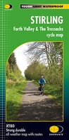 Fietskaart Stirling / Forth Valley &The Trossachs | Harvey Maps
Cycling map of Stirling, the Forth Valley and the Trossachs at 1:80,000 scale Map shows 16 graded cycle routes with detailed route descriptions on reverse Includes enlargement of …
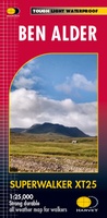 Wandelkaart Ben Alder | Harvey Maps
Superwalker is designed to be the most practical tool for navigation outdoors. The Superwalker XT25 is based on original HARVEY mapping with all the information a walker would expect on …
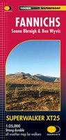 Wandelkaart Fannichs Seana Bhraigh & Ben Wyvis | Harvey Maps
Detailed map for hillwalkers of the Fannichs ridge at the popular 1:25,000 scale. This is an area located to the south of Ullapool and to the west of Dingwall. Includes …
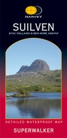 Wandelkaart Suilven / Stac Pollaidh & Ben More Assynt harve | Harvey Maps
Suilven covers the spectacular group of remote northerly munros popular with walkers and climbers. The map area includes Suilven, Canisp, CulMor,Breabag Stac Pollaidh, Conival & Ben More Assynt. This map …
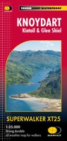 Wandelkaart Knoydart / Kintail / Glen Shiel harvey | Harvey Maps
This remote and beautiful area is often known as 'Scotland's last wilderness'. Detailed map for hillwalkers of Knoydart and Glen Shiel at the popular scale of 1:25,000. Includes …
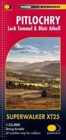 Wandelkaart Pitlochry Loch Tummel & Blair Atholl | Harvey Maps
Detailed map for hillwalkers of Pitlochry, Loch Tummel and Blair Atholl at the popular 1:25,000 scale. Includes Ben Vrackie, Beinn a’ Ghlo and Pass of Killiecrankie. Shows Aberfeldy in …
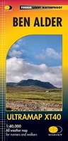 Wandelkaart Ben Alder | Harvey Maps
Covers a large area yet is handily compact. Pocket perfect!Detailed map for runners and walkers of the hills between Loch Tay and Loch Rannoch at the magic scale of 1:40,000.Includes …
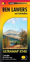 Wandelkaart Ben Lawers & Schiehallion | Harvey Maps
40 years’ experience have gone into HARVEY’s most creative new series. Slim and light, the Ultramap covers a large area and yet is handily compact. Pocket perfect! Includes Ben …
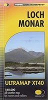 Wandelkaart Loch Monar | Harvey Maps
40 years’ experience have gone into HARVEY’s most creative new series. Slim and light, the Ultramap covers a large area and yet is handily compact. Pocket perfect! The Ultramap …
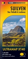 Wandelkaart Suilven / Stac Pollaidh / Lochinver | Harvey Maps
Detailed map for runners and walkers of Suilven and the surrounding area at the magic scale of 1:40,000. Covers a large area yet is handily compact. Pocket perfect! This is …
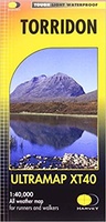 Wandelkaart Torridon | Harvey Maps
Covers a large area yet is handily compact. Pocket perfect!Includes Slioch, Beinn Eighe, Liathach and Beinn Alligin.Detailed map for runners and walkers of the Torridon Hills at the magic scale …
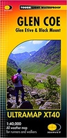 Wandelkaart Glen Coe | Harvey Maps
Covers a large area yet is handily compact. Pocket perfect! Detailed map for runners and walkers of Glen Coe and the Aonach Eagach ridge at the magic scale of …
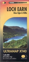 Wandelkaart Loch Earn | Harvey Maps
Covers a large area yet is handily compact. Pocket perfect! Detailed map for runners and walkers of Loch Earn, Glen Ogle and Killin at the magic scale of 1:40,000. …
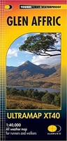 Wandelkaart Glen Affric | Harvey Maps
Covers a large area yet is handily compact. Pocket perfect! Detailed map for runners and walkers of the remote Glen Affric area at the magic scale of 1:40,000. …
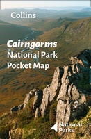 Wegenkaart - landkaart National Park Pocket Map Cairngorms | Collins
Handige kleine kaart van dit Nationaal Park. De kaart geeft een goed en helder overzicht van het gebied met alle plaatsen, doorgaande wandelpaden (alhoewel grof van schaal), bezienswaardigheden etc. Met …
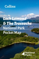 Wegenkaart - landkaart National Park Pocket Map Loch Lomond and the Trossachs | Collins
Handige kleine kaart van dit Nationaal Park. De kaart geeft een goed en helder overzicht van het gebied met alle plaatsen, doorgaande wandelpaden (alhoewel grof van schaal), bezienswaardigheden etc. Met …
 Wandelkaart - Topografische kaart OL58 OS Explorer Map Braemar, Tomintoul & Glen Avon | Ordnance Survey
Met zijn 4cm voor 1 km (2 ½ cm voor 1 mijl) schaal, is de OS Outdoor Leisure kaartenserie de ideale en meest gedetailleerde kaartenreeks voor mensen die graag outdoor-activiteiten …
 Wandelkaart - Topografische kaart 433 OS Explorer Map Explorer Torridon - Beinn Eighe & Liathach | Ordnance Survey
Met zijn 4cm voor 1 km (2 ½ cm voor 1 mijl) schaal, is de OS Explorer kaartenserie de ideale en meest gedetailleerde kaartenreeks voor mensen die graag outdoor-activiteiten zoals …
 Wandelkaart - Topografische kaart 421 OS Explorer Map Ellon & Inverurie, explorer | Ordnance Survey
Met zijn 4cm voor 1 km (2 ½ cm voor 1 mijl) schaal, is de OS Explorer kaartenserie de ideale en meest gedetailleerde kaartenreeks voor mensen die graag outdoor-activiteiten zoals …
 Wandelkaart - Topografische kaart OL62 OS Explorer Map Coreen Hills & Glenlivet | Ordnance Survey
Met zijn 4cm voor 1 km (2 ½ cm voor 1 mijl) schaal, is de OS Explorer kaartenserie de ideale en meest gedetailleerde kaartenreeks voor mensen die graag outdoor-activiteiten zoals …
- 1
- 2
- 3
- Volgende >>
- 9
Laatste reviews

Niet echt voor beginners. Ook zijn de routes soms moeilijk qua logistiek. Weer terugkomen aan het eind bv. En in voorseizoen (mei) blijft er niet …
★★★★★ door Tjeerd 17 mei 2024 | Heeft dit artikel gekocht
Van te voren had ik een andere kaart op het oog. Toen ik in de winkel was adviseerde zij mij deze kaart. Op hun verzoek …
★★★★★ door Koen 17 mei 2024 | Heeft dit artikel gekocht
Ideale schaal waar ook de kleinere wegen duidelijk zijn aangegeven. Beschrijving op website is correct.
★★★★★ door Peter 16 mei 2024 | Heeft dit artikel gekocht
Overzichtelijke kaart. Niks op aan te merken.
★★★★★ door Bastiaan de Leeuw 16 mei 2024 | Heeft dit artikel gekocht