Kaarten - Noord-Amerika
 Wegenkaart - landkaart Hawaii Volcanoes National Park & Big Island | ITMB
Een degelijke kaart met aanduidingen van o.a. nationale parken, vliegveld, benzinepomp, dirt-roads. Als overzichtskaart goed te gebruiken. We didn't suspect, when we started developing this title, that Mauna Loa Volcano …
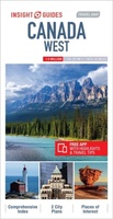 Wegenkaart - landkaart Canada West | Insight Guides
Insight Travel Map Canada West:This detailed travel map is all you need to plan your route and navigate your way around Canada West, and also includes area highlights, top attractions, …
 Stadsplattegrond - Wegenkaart - landkaart Quebec City & Gaspe Peninsula | ITMB
Een degelijke kaart aan twee kanten bedrukt. Aan de ene zijde een plattegrond van Quebec stad, schaal 1:10.000. En aan de andere zijde een wegenkaart, schaal 1:750.000, van Gaspe schiereiland …
 Wandelkaart Yosemite & Central California | ITMB
The USA is blessed with many wonderful parks, forests, and natural monuments that have been preserved for all to enjoy. The second most-visited national park (after Yellowstone) is Yosemite (pronounced …
 Wegenkaart - landkaart Atlantic Canada | ITMB
The first edition was published in 2000 using artwork under licence. This edition uses original ITMB artwork. Side 1 covers Nova Scotia, New Brunswick, and Prince Edward Island as well …
 Stadsplattegrond Plan de ville - Street Map New York | Michelin
NEW. The Michelin New York Map - part of Michelin's brand-new Laminated City Map series - is ideal for visitors wanting to see the sights and navigate around the city. …
 Wegenkaart - landkaart 3128 Adventure Travel Map Vancouver Island | National Geographic
Wegenkaart van Vancouver Island met vermelding van veel bezienswaardigheden, nationale parken en attrakties. Watervast en scheurvast. Juist door deze vermeldingen onderscheidt de kaart zich van andere wegenkaarten. National Geographic's Vancouver …
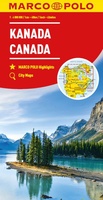 Wegenkaart - landkaart Kanada - Canada | Marco Polo
Marco Polo Canada Map: the ideal map for your trip Let the Marco Polo Canada Map guide you around this incredible country. Plan your great Canadian road trip with …
 Wegenkaart - landkaart Canada East Coast | ITMB
Canada is a vast country in area; inconceivably enormous in European terms. It is best mapped as a series of regional maps and this is the first of two maps …
 Wegenkaart - landkaart US East Coast | ITMB★★★★★
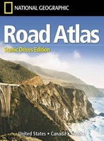 Wegenatlas USA Canada Mexico Road Atlas | A4-Formaat | National Geographic
National Geographic's Road Atlas: Scenic Drives Edition, is the ideal companion for the next time you hit the road for an unforgettable road trip. Includes up-to-date road maps for all …
 Wandelkaart Colorado Day Hikes | Waterford Press
Central Colorado is known as the gateway to the nearby Rocky Mountains, but there are many attractions and beautiful hikes within driving distance of some of the major urban areas …
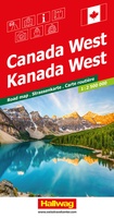 Wegenkaart - landkaart Canada West | Hallwag
Strassenkarte Kanada WestStrassenkarte mit Transitplänen, Ortsindex, touristische Informationen und Sehenswürdigkeiten.Aktuelle Information, übersichtliche Darstellung, einfache Handhabung: das Markenzeichen der Hallwag-Strassenkarten. Das internationale Programm mit neuen Ideen für besseres Reisen bietet Ihnen …
 Wegenkaart - landkaart North America - Noord Amerika | National Geographic
• Waterproof • Tear-Resistant • Reference Map Expertly researched and designed, National Geographic's North America Flags & Facts Map is the authoritative map of North America by which other …
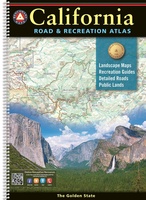 Wegenatlas California Road & Recreation Atlas | A3 Formaat | Ringband | Benchmark Maps
"California is rich in geographical diversity and natural beauty, from its verdant mountains and vast deserts to its seemingly endless Pacific coastline. Get to know the best of California with …
 Wegenkaart - landkaart Jasper National Park (Alberta) | Gem Trek Maps
Waterproof and tear-resistant map for Jasper National Park in the Canadian Rockies. Whether you are a first-time visitor or a long-time local, you’ll find Gem Trek’s Jasper National Park …
 Wegenkaart - landkaart Route 66 | ITMB
Overzichtelijke wegenkaart van een groot gebied. Alles draait om de Route 66 die duidelijk staat ingetekend op deze wegenkaart. Met aanvullende stadsplattegronden (het centrum) van de steden Los Angeles, Flagstaff, …
★★★★★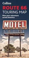 Wandelkaart Touring Maps Route 66 | Collins
Full color, informative map of the famous US Route 66. With detailed mapping, key tourist information and a suggested itinerary, this is a perfect guide for anyone traveling along America’s …
 Wegenkaart - landkaart USA - Verenigde Staten van Amerika | ExpressMap
 Wegenkaart - landkaart USA Southwest - USA Zuidwest | ExpressMap
Laatste reviews

Heb de gids cadeau gedaan en die persoon was er heel blij mee ..
★★★★★ door J 21 november 2024 | Heeft dit artikel gekocht
De kaart van Kirgystan is prachtig, zeer gedetailleerd. Kan niet wachten tot de we echt op reis hmgaan die kant op.
★★★★★ door Marijke Eering 21 november 2024 | Heeft dit artikel gekocht
Super handig fiets boekje en mooi water bestendig. En handig om op de kaarten te kijken heel duidelijk beschrijving. Wij fietsen al jaren in Duitsland …
★★★★★ door Jenneke holterman 19 november 2024 | Heeft dit artikel gekocht
prima kaart levering en betaling allemaal vlot verlopen
★★★★★ door Marc Buts 19 november 2024 | Heeft dit artikel gekocht

