Wandelkaarten - Schotse Hooglanden & Speyside
Overzichtskaarten
-
Overzichtskaart Explorer 25.000 wandelkaarten Noord Schotland
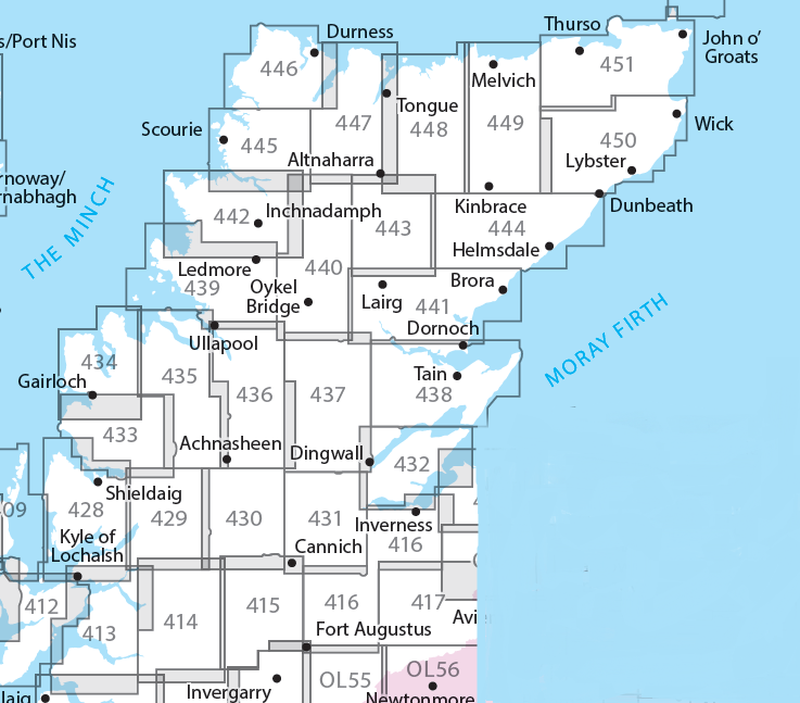
Producten op deze overzichtskaart:
Klik op een product om naar de pagina van dat product te gaan.
- Wandelkaart - Topografische kaart 416 OS Explorer Map Inverness, Loch Ness, Culloden | Ordnance Survey
- Wandelkaart - Topografische kaart 428 OS Explorer Map Kyle of Lochalsh, Plockton, Applecross | Ordnance Survey
- Wandelkaart - Topografische kaart 429 OS Explorer Map Glen Carron, West Monar | Ordnance Survey
- Wandelkaart - Topografische kaart 430 OS Explorer Map Loch Monar, Glen Cannich, Glen Strathfarrar | Ordnance Survey
- Wandelkaart - Topografische kaart 431 OS Explorer Map Glen Urquhart, Strathglass | Ordnance Survey
- Wandelkaart - Topografische kaart 432 OS Explorer Map Black Isle | Ordnance Survey
- Wandelkaart - Topografische kaart 433 OS Explorer Map Explorer Torridon - Beinn Eighe & Liathach | Ordnance Survey
- Wandelkaart - Topografische kaart 434 OS Explorer Map Gairloch / Loch Ewe | Ordnance Survey
- Wandelkaart - Topografische kaart 435 OS Explorer Map An Teallach / Slioch | Ordnance Survey
- Wandelkaart - Topografische kaart 436 OS Explorer Map Beinn Dearg, Loch Fannich | Ordnance Survey
- Wandelkaart - Topografische kaart 437 OS Explorer Map Ben Wyvis, Strathpeffer | Ordnance Survey
- Wandelkaart - Topografische kaart 438 OS Explorer Map Dornoch, Tain | Ordnance Survey
- Wandelkaart - Topografische kaart 439 OS Explorer Map Coigach, Summer Isles | Ordnance Survey
- Wandelkaart - Topografische kaart 440 OS Explorer Map Glen Cassley, Glen Oykel | Ordnance Survey
- Wandelkaart - Topografische kaart 441 OS Explorer Map Lairg, Bonar Bridge, Golspie | Ordnance Survey
- Wandelkaart - Topografische kaart 442 OS Explorer Map Assynt, Lochinver | Ordnance Survey
- Wandelkaart - Topografische kaart 443 OS Explorer Map Ben Kilbreck, Ben Armine | Ordnance Survey
- Wandelkaart - Topografische kaart 444 OS Explorer Map Helmsdale, Strath of Kildonan | Ordnance Survey
- Wandelkaart - Topografische kaart 445 OS Explorer Map Foinaven, Arkle, Kylesku, Scourie | Ordnance Survey
- Wandelkaart - Topografische kaart 446 OS Explorer Map Durness, Cape Wrath | Ordnance Survey
- Wandelkaart - Topografische kaart 447 OS Explorer Map Ben Hope, Ben Loyal, Kyle of Tongue | Ordnance Survey
- Wandelkaart - Topografische kaart 448 OS Explorer Map Strath Naver & Loch Loyal | Ordnance Survey
- Wandelkaart - Topografische kaart 449 OS Explorer Map Strath Halladale & Strathy Point | Ordnance Survey
- Wandelkaart - Topografische kaart 450 OS Explorer Map Wick, The Flow Country | Ordnance Survey
- Wandelkaart - Topografische kaart 451 OS Explorer Map Thurso, John o' Groats | Ordnance Survey
-
Overzichtskaart Explorer 25.000 wandelkaarten Noordoost Schotland - Cairngorms
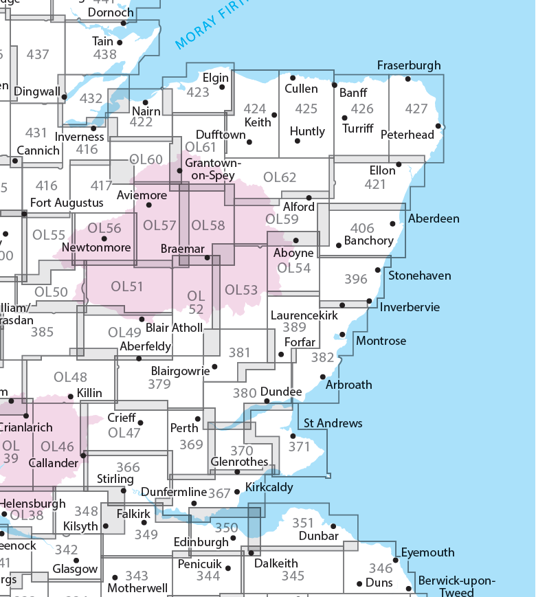
Producten op deze overzichtskaart:
Klik op een product om naar de pagina van dat product te gaan.
- Wandelkaart - Topografische kaart 342 OS Explorer Map Glasgow | Ordnance Survey
- Wandelkaart - Topografische kaart 348 OS Explorer Map Campsie Fells | Ordnance Survey
- Wandelkaart - Topografische kaart 349 OS Explorer Map Falkirk, Cumbernauld, Livingston | Ordnance Survey
- Wandelkaart - Topografische kaart 350 OS Explorer Map Edinburgh | Ordnance Survey
- Wandelkaart - Topografische kaart 351 OS Explorer Map Dunbar, North Berwick | Ordnance Survey
- Wandelkaart - Topografische kaart 366 OS Explorer Map Stirling, Ochil Hills West | Ordnance Survey
- Wandelkaart - Topografische kaart 367 OS Explorer Map Dunfermline, Kirkcaldy, Glenrothes South | Ordnance Survey
- Wandelkaart - Topografische kaart 369 OS Explorer Map Perth, Kinross | Ordnance Survey
- Wandelkaart - Topografische kaart 370 OS Explorer Map Glenrothes North, Falkland, Lomond Hills | Ordnance Survey
- Wandelkaart - Topografische kaart 371 OS Explorer Map St-Andrews, East Fife | Ordnance Survey
- Wandelkaart - Topografische kaart 379 OS Explorer Map Dunkeld, Aberfeldy, Glen Almond | Ordnance Survey
- Wandelkaart - Topografische kaart 380 OS Explorer Map Dundee, Sidlaw Hills | Ordnance Survey
- Wandelkaart - Topografische kaart 381 OS Explorer Map Blairgowrie, Kirriemuir, Glamis | Ordnance Survey
- Wandelkaart - Topografische kaart 382 OS Explorer Map Arbroath, Montrose, Carnoustie | Ordnance Survey
- Wandelkaart - Topografische kaart 385 OS Explorer Map Rannoch Moor, Ben Alder | Ordnance Survey
- Wandelkaart - Topografische kaart 389 OS Explorer Map Forfar, Brechin, Edzell | Ordnance Survey
- Wandelkaart - Topografische kaart 396 OS Explorer Map Stonehaven, Inverbervie & Laurencekirk | Ordnance Survey
- Wandelkaart - Topografische kaart 406 OS Explorer Map Aberdeen, Banchory | Ordnance Survey
- Wandelkaart - Topografische kaart 416 OS Explorer Map Inverness, Loch Ness, Culloden | Ordnance Survey
- Wandelkaart - Topografische kaart 417 OS Explorer Map Monadhliath Mountains North, Strathdearn | Ordnance Survey
- Wandelkaart - Topografische kaart 421 OS Explorer Map Ellon & Inverurie, explorer | Ordnance Survey
- Wandelkaart - Topografische kaart 422 OS Explorer Map Nairn, Cawdor | Ordnance Survey
- Wandelkaart - Topografische kaart 423 OS Explorer Map Elgin, Forres, Lossiemouth | Ordnance Survey
- Wandelkaart - Topografische kaart 424 OS Explorer Map Buckie, Keith | Ordnance Survey
- Wandelkaart - Topografische kaart 425 OS Explorer Map Huntly, Cullen | Ordnance Survey
- Wandelkaart - Topografische kaart 426 OS Explorer Map Banff, Macduff, Turriff | Ordnance Survey
- Wandelkaart - Topografische kaart 427 OS Explorer Map Peterhead, Fraserburgh | Ordnance Survey
- Wandelkaart - Topografische kaart 431 OS Explorer Map Glen Urquhart, Strathglass | Ordnance Survey
- Wandelkaart - Topografische kaart 432 OS Explorer Map Black Isle | Ordnance Survey
- Wandelkaart - Topografische kaart OL46 OS Explorer Map The Trossachs | Ordnance Survey
- Wandelkaart - Topografische kaart OL47 OS Explorer Map Crieff, Comrie & Glen Artney | Ordnance Survey
- Wandelkaart - Topografische kaart OL48 OS Explorer Map Ben Lawers & Glen Lyon | Ordnance Survey
- Wandelkaart - Topografische kaart OL49 OS Explorer Map Pitlochry & Loch Tummel | Ordnance Survey
- Wandelkaart - Topografische kaart OL50 OS Explorer Map Ben Alder, Loch Ericht & Loch Laggan | Ordnance Survey
- Wandelkaart - Topografische kaart OL51 OS Explorer Map Atholl | Ordnance Survey
- Wandelkaart - Topografische kaart OL52 OS Explorer Map | Active Glen Shee - Braemar | Ordnance Survey
- Wandelkaart - Topografische kaart OL53 OS Explorer Map Lochnagar, Glen Muick & Glen Clova | Ordnance Survey
- Wandelkaart - Topografische kaart OL54 OS Explorer Map Glen Esk & Glen Tanar | Ordnance Survey
- Wandelkaart - Topografische kaart OL55 OS Explorer Map Loch Laggan & Creag Meagaidh | Ordnance Survey
- Wandelkaart - Topografische kaart OL56 OS Explorer Map Badenoch & Upper Strathspey | Ordnance Survey
- Wandelkaart - Topografische kaart OL57 OS Explorer Map Cairn Gorm & Aviemore | Ordnance Survey
- Wandelkaart - Topografische kaart OL58 OS Explorer Map Braemar, Tomintoul & Glen Avon | Ordnance Survey
- Wandelkaart - Topografische kaart OL59 OS Explorer Map Aboyne, Alford & Strathdon | Ordnance Survey
- Wandelkaart - Topografische kaart OL60 OS Explorer Map Lochindorb, Grantown-on-Spey & Carrbridge | Ordnance Survey
- Wandelkaart - Topografische kaart OL61 OS Explorer Map Grantown-on-Spey & Hills of Cromdale | Ordnance Survey
- Wandelkaart - Topografische kaart OL62 OS Explorer Map Coreen Hills & Glenlivet | Ordnance Survey
 Wandelkaart Rum, Eigg, Canna, Muck | Harvey Maps
More than "just" a map, this map is an essential piece of equipment, this new generation of HARVEY Superwalkers is designed to be the most practical tool for navigation outdoors. …
 Wandelkaart Suilven / Stac Pollaidh & Ben More Assynt harve | Harvey Maps
Suilven covers the spectacular group of remote northerly munros popular with walkers and climbers. The map area includes Suilven, Canisp, CulMor,Breabag Stac Pollaidh, Conival & Ben More Assynt. This map …
 Wandelkaart Knoydart / Kintail / Glen Shiel harvey | Harvey Maps
This remote and beautiful area is often known as 'Scotland's last wilderness'. Detailed map for hillwalkers of Knoydart and Glen Shiel at the popular scale of 1:25,000. Includes …
 Wandelkaart Pitlochry Loch Tummel & Blair Atholl | Harvey Maps
Detailed map for hillwalkers of Pitlochry, Loch Tummel and Blair Atholl at the popular 1:25,000 scale. Includes Ben Vrackie, Beinn a’ Ghlo and Pass of Killiecrankie. Shows Aberfeldy in …
 Wandelkaart Ben Alder | Harvey Maps
Covers a large area yet is handily compact. Pocket perfect!Detailed map for runners and walkers of the hills between Loch Tay and Loch Rannoch at the magic scale of 1:40,000.Includes …
 Wandelkaart Ben Lawers & Schiehallion | Harvey Maps
40 years’ experience have gone into HARVEY’s most creative new series. Slim and light, the Ultramap covers a large area and yet is handily compact. Pocket perfect! Includes Ben …
 Wandelkaart Loch Monar | Harvey Maps
40 years’ experience have gone into HARVEY’s most creative new series. Slim and light, the Ultramap covers a large area and yet is handily compact. Pocket perfect! The Ultramap …
 Wandelkaart Suilven / Stac Pollaidh / Lochinver | Harvey Maps
Detailed map for runners and walkers of Suilven and the surrounding area at the magic scale of 1:40,000. Covers a large area yet is handily compact. Pocket perfect! This is …
 Wandelkaart Torridon | Harvey Maps
Covers a large area yet is handily compact. Pocket perfect!Includes Slioch, Beinn Eighe, Liathach and Beinn Alligin.Detailed map for runners and walkers of the Torridon Hills at the magic scale …
 Wandelkaart Glen Coe | Harvey Maps
Covers a large area yet is handily compact. Pocket perfect! Detailed map for runners and walkers of Glen Coe and the Aonach Eagach ridge at the magic scale of …
 Wandelkaart Loch Earn | Harvey Maps
Covers a large area yet is handily compact. Pocket perfect! Detailed map for runners and walkers of Loch Earn, Glen Ogle and Killin at the magic scale of 1:40,000. …
 Wandelkaart Glen Affric | Harvey Maps
Covers a large area yet is handily compact. Pocket perfect! Detailed map for runners and walkers of the remote Glen Affric area at the magic scale of 1:40,000. …
 Wandelkaart Glen Coe | Harvey Maps
Includes Buachaille Etive Mor, the Three Sisters of Glen Coe and Bidean nam Bian. Detailed map for hillwalkers of Glen Coe and the Aonach Eagach ridge at the popular …
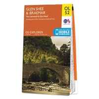 Wandelkaart - Topografische kaart OL52 OS Explorer Map Glen Shee & Braemar | Ordnance Survey
Discover Glen Shee, less than two hours’ drive from all of Scotland’s major cities, yet a place of otherworldly beauty as its name, which translates to ‘the fairy glen’, attests. …
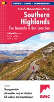 Wandelkaart Southern Highlands XT40 BMM | Harvey Maps
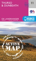 Wandelkaart - Topografische kaart 11 Landranger Active Thurso / Dunbeath | Ordnance Survey
Zeer goede detailkaart met topografische ondergrond. Kleurgebruik is goed over nagedacht: bijzonder goed leesbaar en helder kaartbeeld. Hierop zijn toeristische symbolen van bezienswaardigheden ingetekend, daarnaast staan bijvoorbeeld campings en jeugdherbergen …
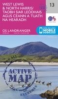 Wandelkaart - Topografische kaart 13 Landranger Active West Lewis / North Harris | Ordnance Survey
Zeer goede detailkaart met topografische ondergrond. Kleurgebruik is goed over nagedacht: bijzonder goed leesbaar en helder kaartbeeld. Hierop zijn toeristische symbolen van bezienswaardigheden ingetekend, daarnaast staan bijvoorbeeld campings en jeugdherbergen …
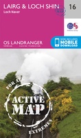 Wandelkaart - Topografische kaart 16 Landranger Active Lairg / Loch Shin | Ordnance Survey
Zeer goede detailkaart met topografische ondergrond. Kleurgebruik is goed over nagedacht: bijzonder goed leesbaar en helder kaartbeeld. Hierop zijn toeristische symbolen van bezienswaardigheden ingetekend, daarnaast staan bijvoorbeeld campings en jeugdherbergen …
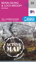 Wandelkaart - Topografische kaart 20 Landranger Active Beinn Dearg / Loch Broom (Ben Wyvis) | Ordnance Survey
Zeer goede detailkaart met topografische ondergrond. Kleurgebruik is goed over nagedacht: bijzonder goed leesbaar en helder kaartbeeld. Hierop zijn toeristische symbolen van bezienswaardigheden ingetekend, daarnaast staan bijvoorbeeld campings en jeugdherbergen …
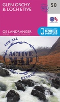 Wandelkaart - Topografische kaart 50 Landranger Active Glen Orchy & Loch Etive | Ordnance Survey
Zeer goede detailkaart met topografische ondergrond. Kleurgebruik is goed over nagedacht: bijzonder goed leesbaar en helder kaartbeeld. Hierop zijn toeristische symbolen van bezienswaardigheden ingetekend, daarnaast staan bijvoorbeeld campings en jeugdherbergen …
Laatste reviews

Heb de gids cadeau gedaan en die persoon was er heel blij mee ..
★★★★★ door J 21 november 2024 | Heeft dit artikel gekocht
De kaart van Kirgystan is prachtig, zeer gedetailleerd. Kan niet wachten tot de we echt op reis hmgaan die kant op.
★★★★★ door Marijke Eering 21 november 2024 | Heeft dit artikel gekocht
Super handig fiets boekje en mooi water bestendig. En handig om op de kaarten te kijken heel duidelijk beschrijving. Wij fietsen al jaren in Duitsland …
★★★★★ door Jenneke holterman 19 november 2024 | Heeft dit artikel gekocht
prima kaart levering en betaling allemaal vlot verlopen
★★★★★ door Marc Buts 19 november 2024 | Heeft dit artikel gekocht

